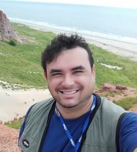
RESEARCHERS
Diógenes Costa, Adjunct/Assistent Professor, Department of Geography
|
Geographer and PhD in Ecology - I study the ecosystems distributions, process and services in tropical landscapes.
|
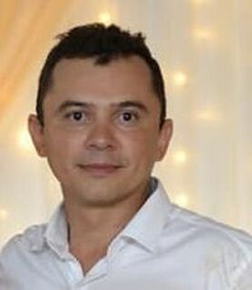
Jânio Guedes, Temporary Professor/Lecturer, Department of Geography
|
Geographer and Master in Geography - In my PhD research I study recente (holocene) evolution of the landscapes at semiarid watersheds by use of remote sensing, GIS, phytoliths and geochronological datin.
|
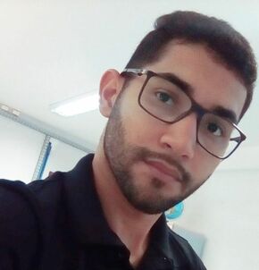
Alisson Oliveira, PhD Student
|
Geographer and Master in Geography - In my research I study the recent (holocene) evolution of montain landscapes and trade-offs between ecosystems services and human actitivies. For this, I use remote sensing, GIS, phytoliths and geochronological datin.
|
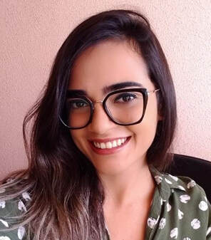
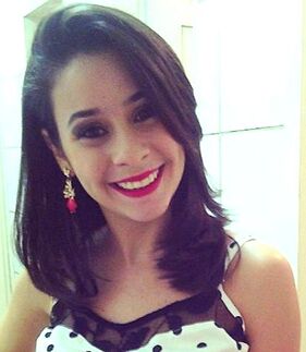
Carol Souza, PhD Student
|
Geographer and Master in Geography - In my research I study regulation ecosystems services provided by coastal wetlands. For this, I use remote sensing, GIS and biogeochemistry.
|
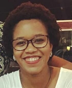
Denise Saldanha, PhD Student
|
Geographer and Master in Geography - In my research I study ecosystems services provided by coastal wetlands and its trade-offs with human actitivies. For this, I use remote sensing, GIS and metrics of landscape ecology.
|
Lamara Cavalcante, PhD Student

|
Biologist and PhD student in Marine Sciences - In my research I study the ethnoecological knowledge and ecosystems services provided by mangrove ecosystems. For this, I use remote sensing, GIS and statistical nonparametric methods.
|
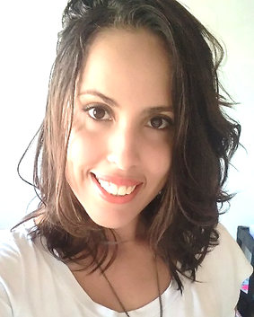
Nayara Santos, PhD Student
|
Geographer and Master in Geography - In my research I study ecosystems services provided by coastal wetlands and its trade-offs with human actitivies. For this, I use remote sensing, GIS and metrics of landscape ecology.
|
Thiara Rabelo, PhD Student
|
Geographer and Master in Geography - In my PhD research I study the quantification of geodiversty in tropical coastal landscapes by use of GIS and geostatiscs.
|
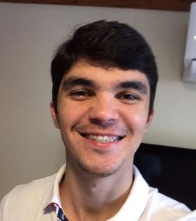
Yuri Souza, PhD Student
|
Geographer and PhD student in Geography - In my research, I study the ecosystem services provided by mangrove ecosystems. For that, I use remote sensing, GIS, landscape ecology metrics and phytosociological parameters.
|
GRADUATE RESEARCHERS
Aline Carvalho (2018-2020)
|
Agroecologist and Master student in Ecology and Conservation - In my research I study the fragmentation process in tropical montane cloud forest and trade-offs between ecosystems services and human actitivies. For this, I use remote sensing, GIS and metrics of landscape ecology.
|
M.Sc. Diego Silva (2013-2021)
|
Geographer and Master student in Geography - In my research I study ecosystems services provided by coastal wetlands and its trade-offs with human actitivies. For this, I use remote sensing, GIS and metrics of landscape ecology.
|
M.Sc. Paulo Oliveira, Researcher (2016-2022)
|
Geographer and Master student in Geography - My interrest research is about plant distributions in semi-arid landscapes and ecosystems services provided by Caatinga ecosystems. I intend to use remote sensing, GIS, multivariate statistics and metrics of landscape ecology
|
M.Sc. Telma Alves, Researcher (2018-2020)
|
Geographer and Master student in Geography - In my research I study methodologies of teaching Geography at basic education by following themes: Caatinga biogeography, semi-arid conditions, human impact in ecosystems and services provided by Caatinga ecosystems.
|
Carlos Filho, Graduate Student (2016-2020)
|
Undergratuate student in Geography - My interrest research is about plant distributions in semi-arid landscapes and ecosystems services provided by Caatinga ecosystems. I intend to use remote sensing, GIS, multivariate statistics and metrics of landscape ecology
|
Douglas Nascimento, PosDoc fellowship of National Institute of Wetlands (2019-2020)
|
Biologist and PhD in Etnobiology and Nature Conservation - In my PostDoc research I study services provided by coastal wetlands. For this, I use remote sensing, GIS and metrics of landscape ecology.
|
Irami Júnior, Graduate Student (2016-2019)
|
Undergratuate student in Geography - My interrest research is about plant distributions in semi-arid landscapes and ecosystems services provided by Caatinga ecosystems. I intend to use remote sensing, GIS, multivariate statistics and metrics of landscape ecology
|
M.Sc. Clésio Araújo, Researcher (2017-2019)
|
Geographer and Master in Geography - In my research I study methodologies of teaching Geography at basic education by following themes: natural resources, semi-arid conditions, human impact in ecosystems and services provided by Caatinga ecosystems.
|
M.Sc. Denize Anjos, Volunteer Professor/Lecturer, Department of Geography (2017-2019)
|
Technologist in Geoprocessing and Master in Forest Science - In my research I study spectral responses of Caatinga vegetation under different landscapes units. For this, I use remote sensing, GIS, multivariate statistics and metrics of landscape ecology.
|
M.Sc. Dayane Guedes (2014-2020)
|
Geographer and Master in Geography - In my research I study ecosystems services provided by coastal wetlands and its trade-offs with human actitivies. For this, I use remote sensing, GIS and metrics of landscape ecology.
|
